
THE AQUEDUCTS OF SAINTES
Level 02 – ROMAN EXPERTISE
Throughout its history, the Roman Empire never failed to make the control of water a key element of its cultural development.
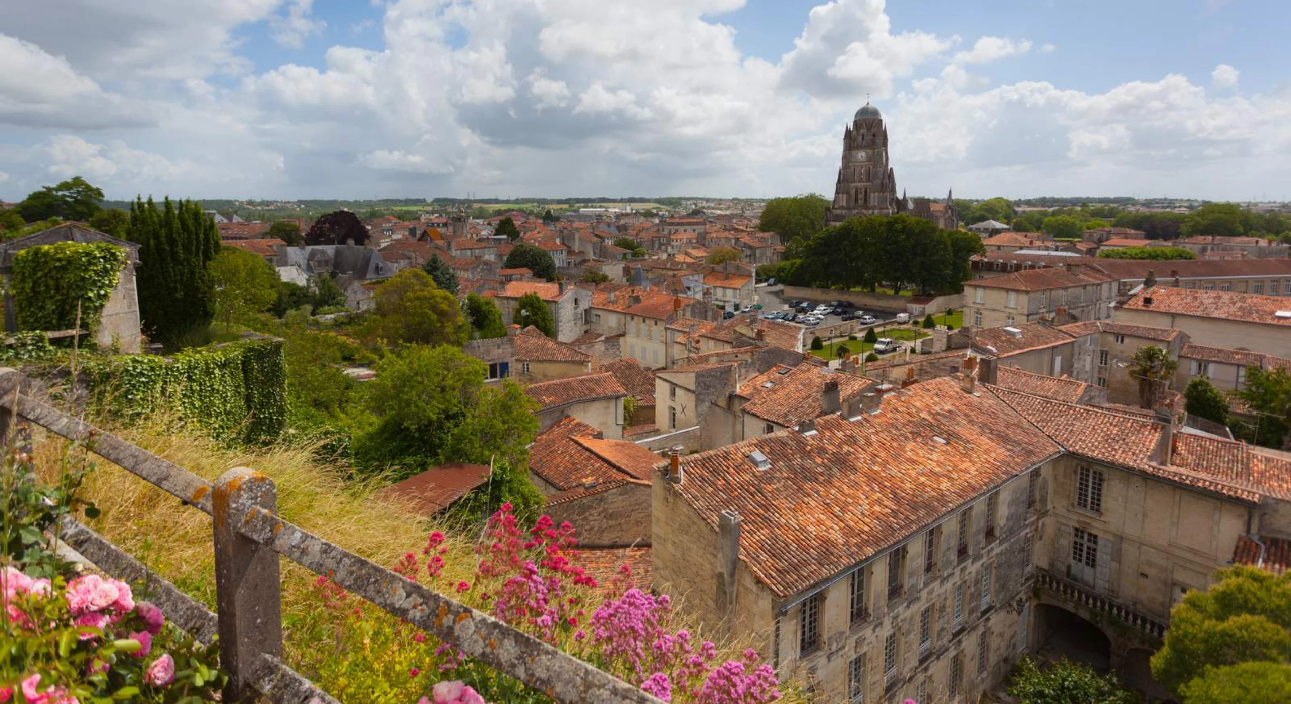
Although far from Rome, Saintes, as the capital of Aquitaine Gaul, had an aqueduct, baths, and an amphitheater, embodying the three markers of Roman civilization and grandeur.
Level 01 – THE CONSTRUCTION OF AN AQUEDUCT
In Saintes, three water sources were exploited, with conduits converging as the population and demand increased. In its final form, with all sources connected, the aqueduct spanned approximately 17 km.
Level 00 – HYDRAULIC POWER
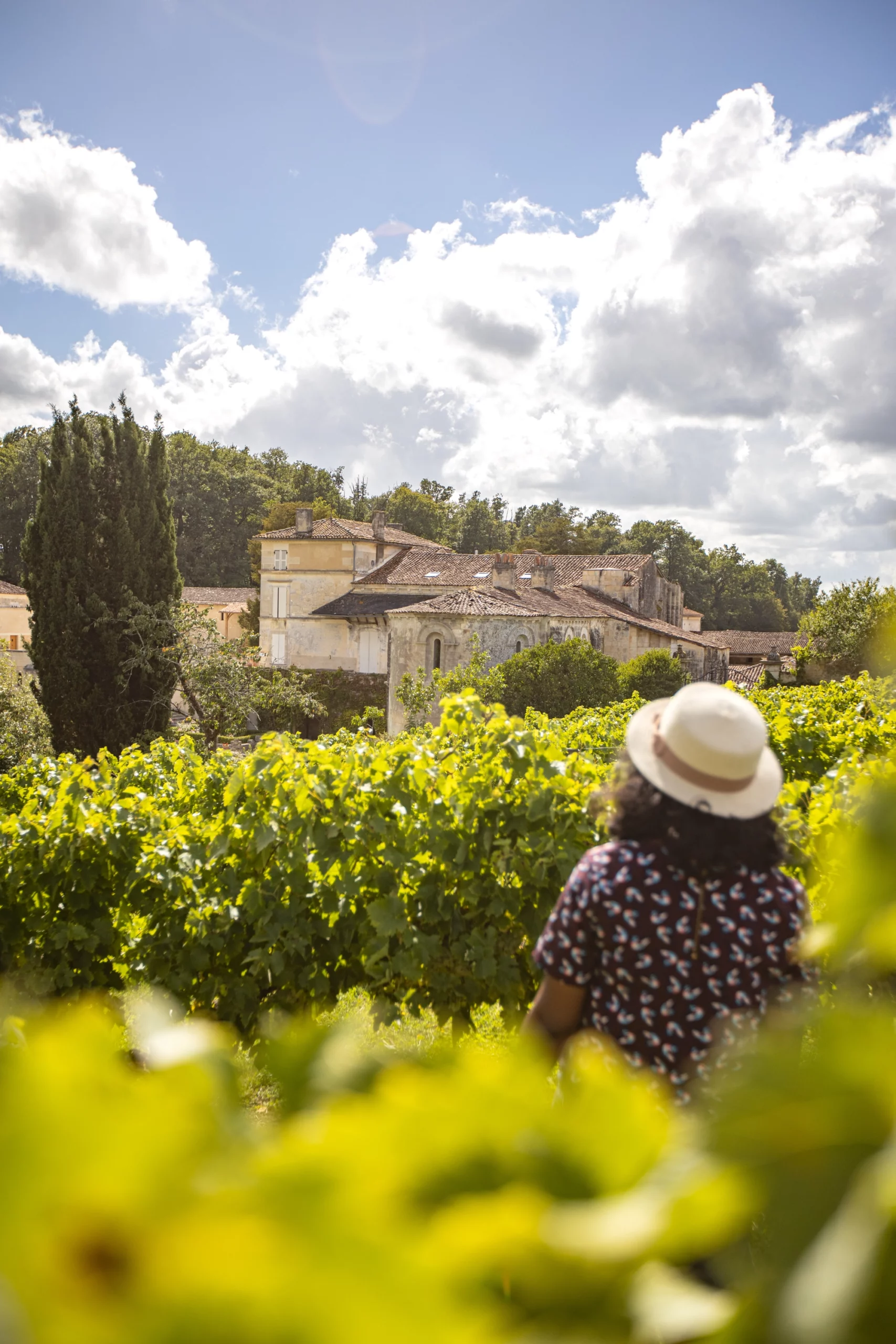
You are here in Vénérand, at the site of the second of three water sources used to supply Saintes. The mill you are entering, built later, harnessed hydraulic power to grind grain.
LEVEL 2
ROMAN EXPERTISE
ROMANIZATION – THE TRANSMISSION OF CULTURE
From its conquest of Gaul, Rome sought to demonstrate the benefits of the Empire to its new citizens. This shrewd and strategic policy introduced spatial and urban organization that fostered economic prosperity while offering new amenities, such as enduring and spectacular architectural techniques, and urban comfort through water accessibility—for domestic use and unprecedented leisure activities like baths. Water unmistakably became a hallmark of Roman civilization.
The realization of this program was made possible by a road network established by Agrippa. Lugdunum (Lyon), the capital of Lyonnaise Gaul, served as the hub of this network, with one road leading to Mediolanum (Saintes). Strabo, a geographer of that era, remarked:
« Agrippa made Lugdunum the starting point for major roads… like the one crossing the Cemmene Mountains (Auvergne) to the Santones and Aquitaine. »
ROMANIZATION – THE TRANSMISSION OF EXPERTISE
The presence of legions in Gaul was not solely for strategic purposes. Legionnaires were trained in the construction of infrastructure and fortifications. The legion included a corps of architect-engineers skilled in planning and overseeing such works, with the renowned Vitruvius, serving under Caesar, being a notable example.
These experienced men trained the first generations of Gaulish builders in Roman techniques. Additionally, legion technicians specialized in topography, charted roads, and aqueducts. Saintes, therefore, was an early beneficiary of these innovations, with the presence of an aqueduct—one of Gaul’s first—a stone bridge over the Charente River, and an imposing honorary arch marking the terminus of the Via Agrippa. Baths and a large amphitheater followed, demonstrating the city’s integration into the Empire.
SPATIAL SEQUENCE
LOCATING AN ABUNDANT SOURCE
The area supplying water to the Saintes aqueduct is a karstic limestone massif. According to this geological definition, it contains underground rivers, which in Saintonge are shallow and fed by numerous rock fissures.
The « sources » mentioned for supplying the Saintes aqueduct were actually captures of underground rivers detected by the sound of water, perceptible through surface fissures and fractures. This water sourcing technique was implemented early in the region by creating access wells. This familiar regional method was naturally utilized by the Romans.
TRACING THE PATH OF LEAST RESISTANCE
The first step is to locate a permanent, high-flow source capable of supplying a city of about 10,000 inhabitants. Additionally, its elevation must be sufficient to allow water to flow naturally to the city. This search was led by the architect and surveyor, guided by a villicus, a local farmer familiar with the terrain.
Once the site was located, the surveyor would verify its altitude and determine the most suitable route to minimize construction challenges.
Below is the route of the aqueduct, which carried water from the sources of Font Morillon, La Grand Font, and Vénérand to Saintes.
1 – THE AQUEDUCT’S ROUTE
ROMAN ORGANIZATION
The curator aquarum (water curator) of Mediolanum Santonum oversaw the construction of the aqueduct. He ensured compliance with the descriptio (design) outlined in the forma (architectural plan). Subsequently, he supervised the maintenance of the structure and the city’s water distribution network.
LUCIUS POPIDIUS AMPLIATUS
CURATOR AQUARUM
« I, Lucius Popidius Ampliatus, curator aquarum, responsible for all water-related matters in the urbs (city) of Mediolanum, have been entrusted by the imperative recommendation of Marcus Agrippa, sent to Gaul by Augustus, to plan the construction of an aqueduct capable of providing running water to the young capital of the beautiful province of Aquitania. »
Lucius Popidius Ampliatus, the curator, commanded and supervised the aqueduct’s planning and construction.
2 – A TEAM OF SPECIALISTS FROM ROME
The technicians selected by the curator recruited workers to operate under their direction. Demetrius, the architect, came from Rome, while Aemilius, the agrimensor-librator (surveyor), and Numerius, the lapicidinarius (stonemason), were detached from the renowned Legio VIII Augusta, Augustus’s favored legion stationed in Aquitaine.
Their first task—finding a water source—was carried out by the architect and surveyor, guided by a villicus, a local Gaulish farmer familiar with the region.
DEMETRIUS – ARCHITECTUS
« I, Demetrius, architectus, will undertake the search for a source suitable for Mediolanum’s needs with the surveyor. The source’s capture point must be sufficiently elevated for the water to naturally reach the city. »
AEMILIUS – AGRIMENSOR
« I, Aemilius, agrimensor and librator, a leveling specialist, have conducted surveys with the architect to locate a source favorable in both elevation and flow. Once identified, I performed leveling from the capture point to Mediolanum using the chorobate, the appropriate instrument for this task. »
NUMERIUS – MONITOR LAPICIDINARIUS
« I, Numerius, lapicidinarius, will estimate the volume of stone needed to build the canal leading water to Mediolanum. The construction of masonry galleries and aerial structures will require a significant amount of stone and lime. »
3 – LEVELING WITH THE CHOROBATE
The leveling operations essential for building an aqueduct require great expertise. The librator constantly directed and monitored the alignment of the canal, a particularly delicate task in underground sections.
Procedure
The chorobate was horizontally aligned using wedges to adjust one end’s height.
Plumb lines verified horizontal alignment by matching engraved fiducial marks.
A final check could involve observing water’s surface in the chorobate’s upper canal.
The assistant recorded the reading using a cursor moved vertically.
4 – THE GROMA – A SURVEYING INSTRUMENT
The groma, used by the agrimensor (surveyor), was an instrument for orthogonal alignments, allowing the tracing of routes, placement of structures, or the drafting of plans. One such instrument was found in Pompeii. Using the groma, the surveyor established stakes marking the aqueduct’s route.
(Photo caption)
Photo of the groma cross found in Pompeii
(Source: Photothèque IRAA, CNRS).
Methodology
From the selected source, the surveyor traced the aqueduct’s path, continually verifying levels and marking the route. The groma, mounted on a spiked base, featured a cross with perpendicular arms, each equipped with a plumb line. The cross could pivot, allowing precise sighting.
This instrument enabled various surveying tasks, such as terrain mapping, structure placement, and aqueduct route marking. A reconstruction of the groma from Pompeii, based on depictions in reliefs, has demonstrated its effectiveness.
(Illustration caption)
Alignment using two groma plumb lines to locate a point on the route.
Orthogonal sighting with two other plumb lines determines spatial positioning.
LEVEL 1
CONSTRUCTION OF THE AQUEDUCT
The curator aquarum of Mediolanum, Lucius Popidius Ampliatus, managed all matters concerning the city’s water supply. His first mission was to plan an aqueduct capable of providing abundant water for Aquitania’s capital. He assembled experienced technicians to draft and supervise the project: an architect, a stonemason, and a surveyor.
Stonemason’s Role
The stonemason sought the nearest usable quarry along the route and planned the transport of materials. A large workforce was recruited, including servi (slaves) for heavy labor and free citizens (mercenarii) for skilled work. Slaves also received remuneration (commoda), albeit lower than wages for free workers.
The caementarius, who oversaw the masons, ensured a steady supply of lime for mortar production. This lime was processed in kilns managed by calcarii (lime burners). Once on site, the masons mixed lime with sand and water to prepare mortar.
Carpenters’ Role
Aerial structures required extensive scaffolding, constructed from wood secured with ropes. Arches and vaults necessitated precisely shaped wooden frameworks to support their weight during construction. These frameworks were only removed once the mortar had fully set.
(Illustration captions)
- The structor spreads mortar with a trowel.
- The caementarius places stones to build walls.
- Carpenters manage scaffolding and framework for arches and vaults.
1 – STONEWORK
Stone extraction, carried out by quarry workers, was sometimes far from the construction site, requiring careful planning of transportation. On-site, stones were roughly shaped to reduce transportation weight, yielding a variety of materials:
- Small stones for masonry.
- Large, shaped stones for lintels and slabs.
- Raw rubble (caementa) for concrete aggregates.
(Illustration captions)
1–3: Quarry preparation and stone cutting.
A: Carrus (one-wheeled cart) for transporting materials.
B: Lifting tripod with a winch for heavy loads.
Tools
Key tools included:
- Cutting hammers, chisels, and points.
- Squares and levelling instruments.
2 – PREPARATION OF MORTAR AND CONCRETE
Mortar required two main components: limestone and sand. Limestone was burned at 1,000°C to create quicklime. After cooling, the lime was hydrated in pits to produce slaked lime, a paste later mixed with sand and water on-site.
Mortar Recipes
Vitruvius detailed various mixtures:
- Standard mortar: 1 part lime, 3 parts sand, 0.5 parts water.
- Waterproof mortar: 1 part lime, 2 parts sand, 1 part crushed tile (ceramic), and 1-part water.
This “pink mortar” was used to seal basins and aqueduct channels. Concrete (rudus), a mix of mortar and rubble (caementa), formed the core of walls and arches.
(Illustration caption)
Recipe for waterproof mortar.
3 – UNDERGROUND CONSTRUCTION
Although Roman aqueducts are famed for aerial structures, much of their routes were underground. At Saintes, the sources were below ground, requiring galleries to be dug to access them.
Methods
- In soft ground: Trenches were dug, the channel built in masonry, and the trench backfilled.
- In rocky terrain: Galleries were carved directly, creating natural walls and vaults.
Intermediate shafts ensured ventilation and alignment accuracy during excavation.
(Illustration captions)
1–4: Sequence of underground construction.
A–D: Sections of Saintes aqueducts and comparable examples in Lyon and Bourges.
4 – CONSTRUCTION OF AN ARCH
The crossing of the Arcs valley presented the first significant obstacle for the aqueduct. This 150-meter-wide and 16-meter-deep depression was bridged by an aqueduct bridge built with small stone blocks. Historical drawings and remnants of the piers suggest it had 27 arches.
Unlike earlier wall-like bridges, this structure demonstrated the Roman builders’ expertise in overcoming natural obstacles through their mastery of arch construction.
The bridge, designed to reduce weight and provide cross-access at ground level, featured a succession of arches. The architect carefully evaluated soil stability to determine the depth and size of the foundations for each pier. The masons, chosen for their experience, constructed the piers and arches, while the surveyor (librator) ensured proper levels for water flow.
(Illustration captions)
- A: Masons placing arch stones on wooden centering frameworks.
- B: Arches supporting the water channel, later covered as throughout its route.
Key statistics:
- 27 arches, 16 m height.
- 2,500 tons of stone and 1,000 tons of mortar used.
- Construction duration: 1 year.
5 – CONSTRUCTION OF A SIPHON
Near Saintes, a major depression and the crossing of the Carantonus River (Charente) necessitated innovative solutions. Instead of building two aqueduct bridges, Roman engineers installed two siphons: one aerial and the other submerged.
The siphon, based on the principle of communicating vessels, allowed water to descend into a curve and rise back to its original level. From an upstream reservoir (chasse), water flowed through lead pipes of large diameter (28–29 cm) down the slope, across the depression, and back up to a downstream reservoir (fuite).
To avoid pipe damage from pressure (e.g., hydraulic shock), engineers mitigated the drop’s height by constructing an intermediate siphon bridge, as Vitruvius recommended. Such a structure remains visible on the Gier aqueduct near Lyon.
(Illustration captions)
- Diagram of lead pipes used in siphons.
- C: Height of drop or « arrow. »
- D: Loss of pressure or elevation difference.
EVOLUTION OF WATER SUPPLY IN SAINTES
The gradual construction of three aqueducts in Saintes increased the city’s water supply, reaching up to 25,000 cubic meters per day. This capacity was significant compared to the Nîmes aqueduct, which provided 35,000 cubic meters daily.
(Graph and comparison)
- Daily flow for Saintes aqueducts:
- 1st aqueduct: 3,000 m³/day
- 2nd aqueduct: 20,000 m³/day
- 3rd aqueduct: 25,000 m³/day
(Diagram caption)
Cross-section showing the siphon bridge at the Charente River crossing.
LEVEL 0
FROM ROMAN CONDUITS TO A 17TH-CENTURY GRAIN MILL
(Location marker: You are here)
This location was chosen for its clear, abundant water flow, despite a technical challenge: the water’s depth. The karstic limestone massif contains underground rivers, shallow here, where fissures expose the sound of flowing water.
The Romans, using their technical knowledge, drilled directly above one fissure, capturing a steady water flow to supply their aqueduct.
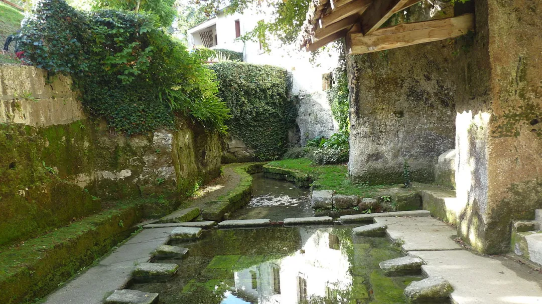
After centuries of use, the aqueduct fell into disrepair. However, the water continued to emerge at the same location, accessible via a Roman-built staircase. This abundant water source naturally became a focal point for later exploitation, such as the 17th-century construction of a grain mill.
The Mill
The mill used the water’s force to drive a wheel and grind grain. Though the aqueduct ceased functioning, the water resumed its natural underground course. Today, the wheel is no longer operational, but the water continues its flow.
(Illustration captions)
- Cross-section of the mill’s lower levels.
- Front view of the mill showing its underground structures.